
24 Jan, 2026
2 min read
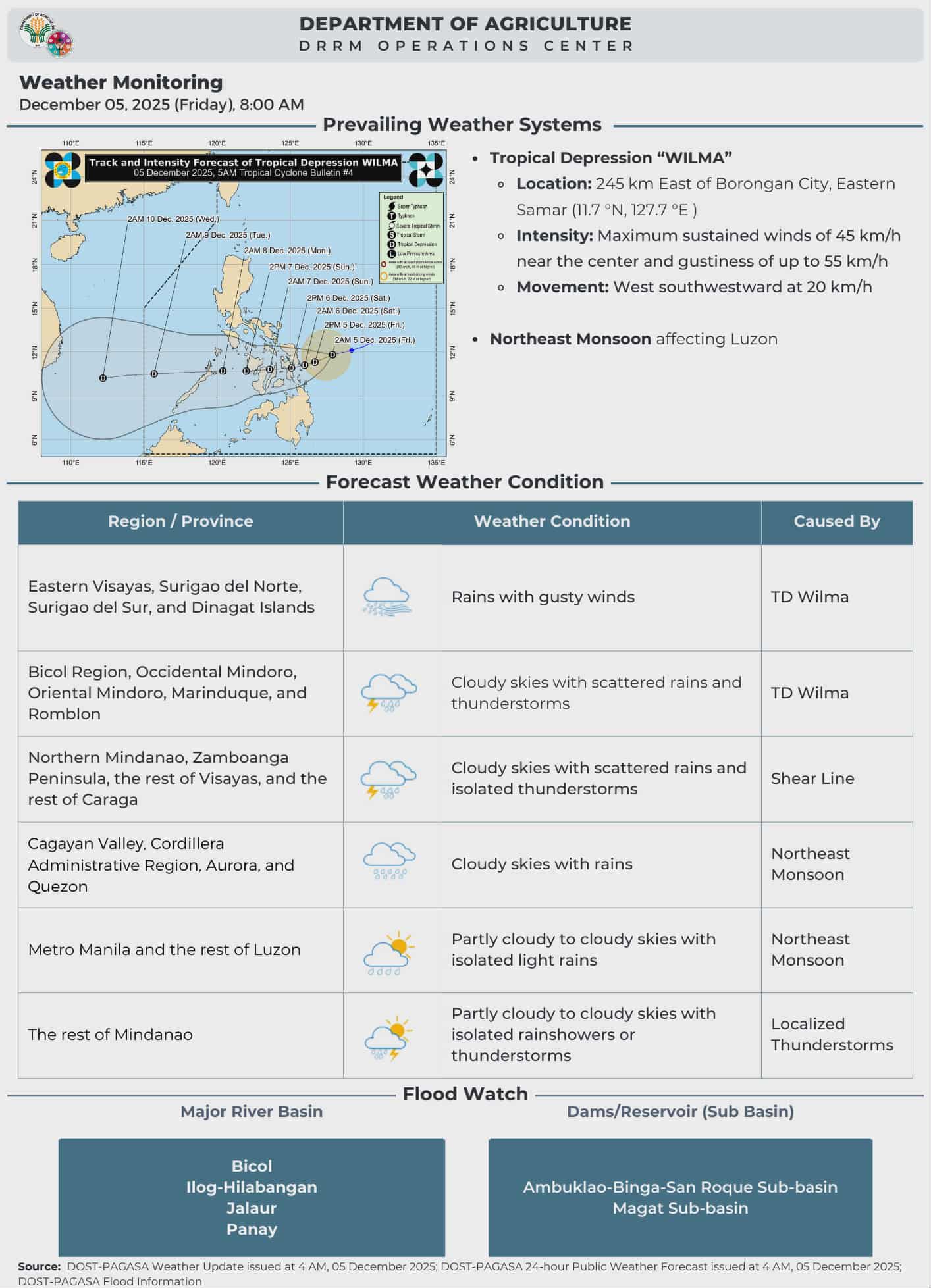
Tropical Depression Wilma Makes Dual Landfall in Eastern Samar, Brings Stormy Conditions Nationwide
Tropical Depression Wilma made two landfalls in Eastern Samar late Saturday night and is currently moving inland across the province, delivering strong winds, heavy rains, and dangerous sea conditions nationwide, the state weather agency reported.\n\nWilma first hit Dolores at 10:50 p.m., followed by a second landfall in Oras at 11:10 p.m. As of late evening, the depression was positioned over Oras, Eastern Samar.\n\nThe weather disturbance is forecasted to continue heading westward, crossing the Visayas region today before entering the Sulu Sea. It may reach northern Palawan by Monday morning. Despite its movement, Wilma is expected to maintain tropical depression status throughout, although the northeast monsoon surge could cause it to weaken into a low-pressure area sooner than anticipated.\n\nTropical Cyclone Wind Signal No. 1 remains in effect for affected localities, with forecasters cautioning about minor to minimal impacts from persistent strong winds. They also noted that winds could intensify somewhat in coastal and elevated regions facing the prevailing winds.\n\nBeyond the immediate path of the storm, strong to gale-force gusts continue to affect most of Luzon, Visayas, and the Zamboanga Peninsula due to the northeast monsoon, with these conditions expected to persist through Sunday and Monday.\n\nThe weather bureau emphasized that hazardous weather, including heavy rainfall and powerful winds, may extend well beyond Wilma’s landfall zones as a result of its interaction with the shear line influencing the country’s eastern areas.
Recommended For You

Philippine Stock Exchange Index Advances Amid Bargain Buying While Peso Weakens
Jan 24, 2026
Maria Santos

Muntinlupa Vice Mayor Tours Alabang Philippines Temple Ahead of Public Open House
Jan 24, 2026
Maria Santos

Team Philippines Reflects on Competing with Manny Pacquiao in "Physical: Asia"
Jan 24, 2026
Juan dela Cruz

Advice on Handling Threats in a Complex Relationship Situation
Jan 24, 2026
Paolo Benitez